
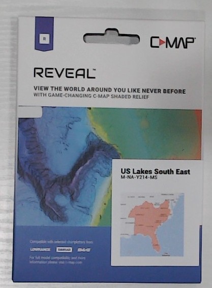
Description
C-MAP M-NA-Y214-MS Reveal Inland South East US
- High-definition C-MAP Reveal layer on selected areas
- Reduces search time with immediate high-definition display of bottom structure, wrecks, isolated reefs and ledges
- Easy to use: just turn on Shaded Relief setting in chartplotter
- C-MAP Reveal charts contain full C-MAP MAX-N+ vector navigation data, including new features like High Resolution Bathy, Custom Depth Shading, Genesis layer and satellite imagery
- Includes detailed marina and port plans
- Most affordable sea bottom charts available

Reviews
There are no reviews yet.